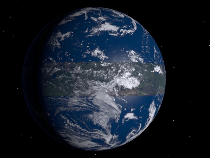
I’ve done many images of Serees for various purposes. This is a near-photorealistic one I dashed off in Blender; texture maps done in Photoshop; clouds courtesy of NASA.
Where are we? On the north shore almost at the right edge of the planet is Czep-tan. On the southern shore, below Czep-tan, is Brisma-tan. Back on the north shore, about 1/3 of the way over from the left edge is Fan-tan. Directly south of Fan-tan, on the opposite shore, is Miklao-tan.
The equatorial lake you see a little to the west of Fan-tan, but still in daylight, is Nafroi-ip. Farther to west, just covered by darkness, is the largest lake on Serees: Margan-ip.
[Update: Since I posted this a few people wondered if I’d animated it. Well…. OK, fine, yes I did. I’m embedding four days of Serees rotation. Enjoy.]
http://youtu.be/8tVOtdXykP4